


What to see and do in Laki?
1. Hike up to the Laki crater (Lakagígar) to take in the entire lava field
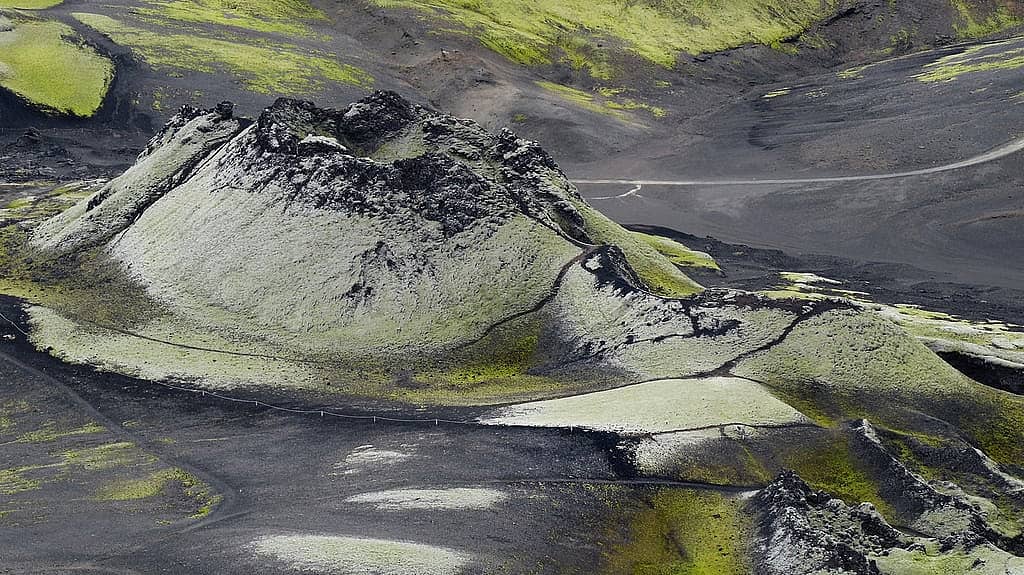
The view from the heights of Laki is the best way to grasp the scale of the 1783 eruption, when a long volcanic scar split the earth open for nearly 17 miles. The trail climbs gently over black ash and brick-red scoria, with gritty basalt crunching underfoot. At the top, you’ll see a frozen sea of moss-covered lava, velvety green, and in the distance, the white tongues of the Vatnajökull glaciers.
On a clear day, low light brings out every ridge, cone, and hollow. Take your time, the wind can be sharp, and the place calls for quiet. Local experts often recommend going late in the day, when the colors deepen and the site begins to empty.
2. Drive the F206 into the heart of Laki, a soft adventure
Getting to Laki is already a journey, along a Highland track that crosses a lunar landscape before slipping into moss and ash. The F206 has to be earned, and it’s best enjoyed slowly, windows cracked open to take in the cold air and its mineral scent. Follow the signs for “Lakagígar” and head deeper into a raw, almost intimate Iceland, far from the main roads.
Depending on the season, you may come across a few river crossings, which makes a four-wheel-drive vehicle essential. For a smoother trip, let a local expert plan your access based on current conditions. Here, the weather changes fast, and it sets the pace.
3. Walk among cones and fissures, close to the lava
The real thrill is standing at human scale beside the fissure, sensing living geology in a calm, settled form. Between the craters, paths wind through a mosaic of jagged rock, black sand, and thick moss like a skin. Every step reveals a new shade, acid green, charcoal gray, rusty brown, and the constant contrast between soft plant life and volcanic matter.
The walk is accessible, but the ground remains uneven. A local guide can help you read the landscape, spot old lava flows, and understand why this eruption left such a mark on Iceland, in its stories and its collective memory.
4. Stop at Fjaðrárgljúfur canyon, the perfect prelude before or after Laki
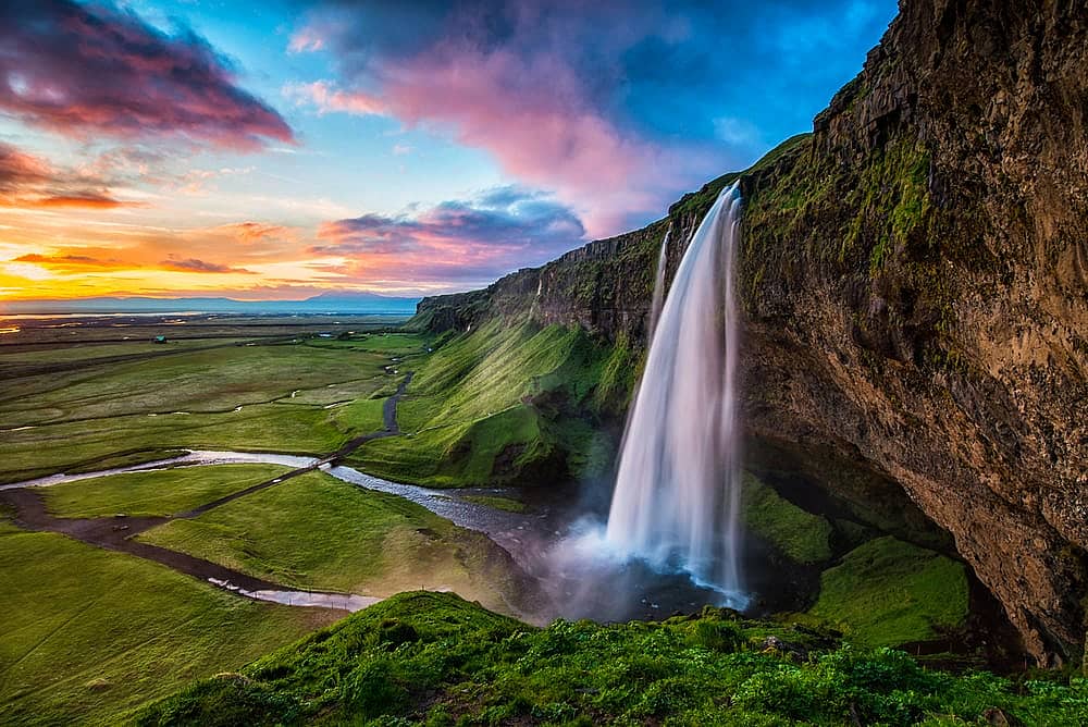
Fjaðrárgljúfur is close by, and it makes a beautiful transition between the coast and the Highlands. The canyon opens like a deep green cut in the land, with a milky river winding far below, sometimes calm, sometimes lively. The rim trail is short, but each viewpoint feels like stepping through a giant model sculpted by water and time.
Come early or late in the day for a quieter atmosphere. Stay on marked trails, the moss is fragile here, too. It’s an ideal pause to stretch your legs and sharpen your eye before diving back into Laki’s basalt world.
5. Kirkjugólf and Kirkjubæjarklaustur, the ideal base for exploring
Kirkjubæjarklaustur is the easiest base for organizing your Laki hike, with gentle hills, walking trails, and the feel of a small South Iceland village. Before heading onto the track, take a detour to Kirkjugólf, the natural “church floor,” a pavement of basalt columns that looks like a geometric floor placed there by magic. Under your fingers, the stone feels cold, smooth in places, rough in others.
Nearby, you’ll also find short hikes, viewpoints, and peaceful spots for a picnic facing the mountains. Local teams often use the village to sort out logistics, check the weather, and send you toward Laki at the right time.
Our tips for discovering Laki
Can you hike up Laki, and how difficult is the climb?
Yes, the hike up Laki does not involve any major technical difficulty, as long as you are self-sufficient and well equipped. You’re not “climbing” an alpine peak, you’re walking along ridges of black scoria, sometimes slippery, with wind and fast-changing weather. Plan on around two to three hours of walking.
The most demanding part is the access and the terrain. The F206, open only in summer, requires a four-wheel-drive vehicle and river crossings, unless you go with a local expert. Once there, the elevation gain is moderate, but loose stones roll underfoot, fog can make it easy to lose your bearings. Bring sturdy shoes, a windproof layer, and set out early to enjoy views of the craters lined up like a scar.
Can you hike at Lakagígar?
Yes, you can hike at Lakagígar, in the heart of Vatnajökull National Park, along this chain of craters born from the 1783 eruption. But it’s a Highland walk, remote and rugged, and it takes preparation. Access, weather, and track conditions often determine whether the outing is possible.
The trails follow the line of craters, between black scoria, fragile moss, and open views over volcanic sands. Most routes are easy to moderate, but they are exposed to wind, with no shade and few water sources, so sturdy shoes and a windproof layer are essential. The best season runs from late June to early September, when the F-roads are generally open. After rain, mud and river crossings can make the approach more complicated.
Where can you see Lakagígar from?
To see Lakagígar, the easiest option is to head for the viewpoint on Mount Laki, accessible in summer via the F206 from Kirkjubæjarklaustur, followed by a rewarding climb on a black-ash trail. From the top, your gaze drops over the line of brick-red craters set in a carpet of acid-green moss, with the occasional smell of sulfur drifting on the wind. Another, more tucked-away option is the Tjarnargígur viewpoint, often quieter at sunrise.
Add a stop at Laki to a tailor-made trip in Iceland
With Evaneos, you’ll connect directly with a local, English-speaking expert based in Iceland. They know the roads, the unpredictable weather, changing schedules, and the best windows for reaching Laki without stress. The result is practical, real-time advice and the reassuring feeling of having someone on the ground.
Together, you’ll build a tailor-made trip, from Laki to the Eastfjords, with quiet hot springs and welcoming, locally run guesthouses along the way. Your trip is shaped around your pace, your budget, and what you want to experience.